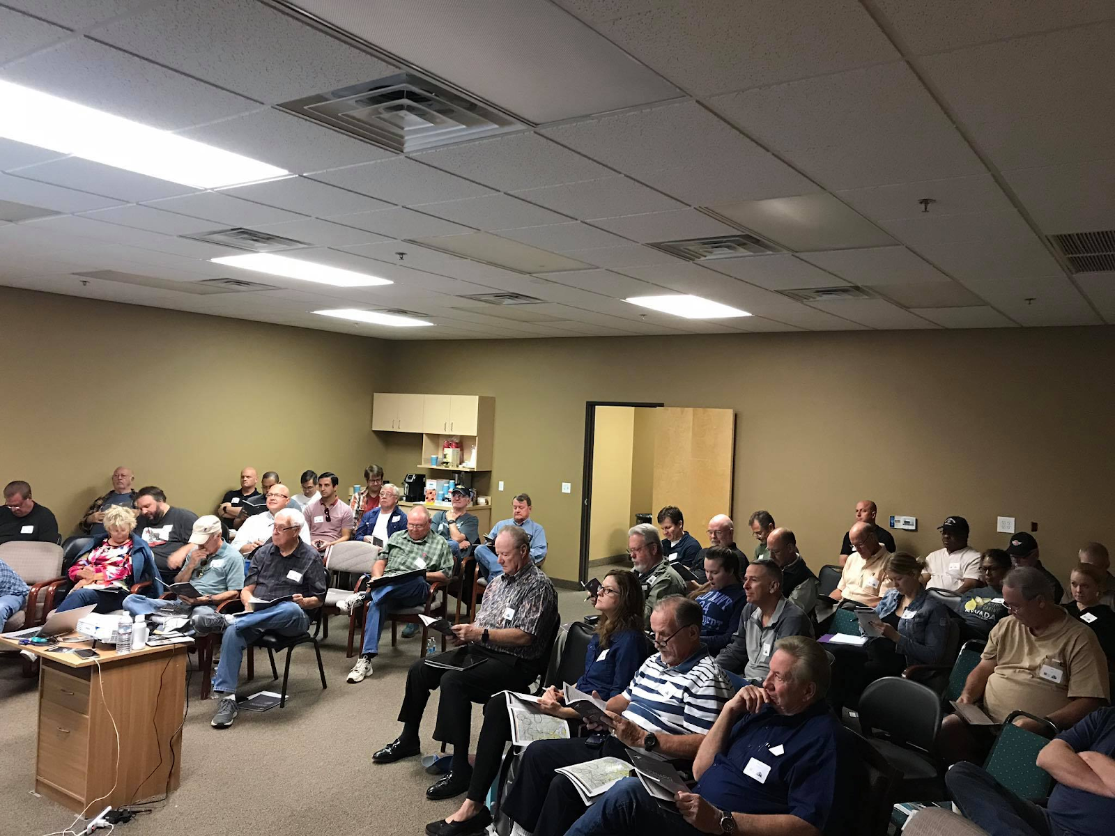
DFC held our online March safety seminar. Alan Zwift for the DFC safety committee presented about Weather or not to fly. Understanding weather and making good decisions about it is essential for safe GA flying.
DFC held our online February safety seminar, where We reviewed Risk Management, ADM and SRM concepts from FAA publications and through common flight scenarios such as preflight, take-off brief, pattern ops and examples from the AOPA “There I Was” podcast series. We applied them to actual flight scenarios.
By Lauren Scott, CFI
One of the greatest benefits of flying general aviation planes out of Henderson Executive Airport is the variety of exciting destinations that can be reached in just a few hours (or less!). Our location in the Las Vegas Valley puts us in close proximity to world-famous national parks, national recreation areas, beaches, deserts, ski slopes, canyons, and mountains. Whether you enjoy the outdoors, dining, or upscale resorts, when you fly out of Henderson there are plenty of locations from which to choose. Read on for more information on some of the nearby airports club members enjoy flying into. As always, please consult the chart supplement and other FAA-approved publications for the most current flight planning information.
Distance from Henderson: 57 nm


Highlights
Bullhead City is on the east side of the Colorado River, 57 nautical miles southeast of Henderson. A sister city to Laughlin, Nevada directly across the river, Bullhead and Laughlin are known for their water sports, fishing, and small community of casinos in Laughlin. The weather is similar to Las Vegas, and the proximity to the water makes this a popular destination for pilots. There are many dining options in the towns of Bullhead and Laughlin. The surrounding scenery on approach and departure from IFP is breathtaking. Check out www.visitarizona.com/places/cities/bullhead-city/ for more information.
Good to Know
While KIFP is a class D airport with daytime tower operations and generally low traffic volume, they do have scheduled commercial flights into the airport in large passenger jets like B737s. It’s also a popular destination for student pilot operations from other locations. The wind can pick up unexpectedly due to nearby terrain and the river and become quite gusty. Small piston aircraft can expect a $29 handling fee, which can be reduced to $5 with a purchase of at least 10 gallons of fuel. There is also a courtesy car for pilots to use for up to 2 hours on a first-come, first serve basis. Please see www.flyifp.com for more airport details.
Distance from KHND: 64 nm


Highlights
Grand Canyon West airport is located 64 nm east of Henderson. Owned and operated by the Hualapai tribe and located on their reservation, the airport is home to many helicopter, airplane, and bus tours. The famous Skywalk is located just ½ mile from the airport, but please note that purchased tour tickets are required for anyone leaving airport property. Even if not leaving the airport, the scenery is absolutely breathtaking flying into and out of Canyon West. Being so close to Henderson, it really is a must-see airport for the scenery. If you are going to do a lot of flying over the rest of the Grand Canyon, it is a good stopping point to stretch your legs and use the restroom before continuing your flight.
Good to Know
Depending on the season, Canyon West can be VERY busy with tour traffic, so monitor the radio carefully and make recommended radio reports for this class G airport. There are nice restrooms, a snack bar, and a large gift shop available, with no landing fees. There is no fuel, and tie-downs may not be available, so bring some straps with you if you plan to stay for a while. Please see www.grandcanyonwest.com for more airport and amenity details.
Distance from KHND: 72 nm


Highlights
Kingman, Arizona started as an old railroad town located 72 nm to the southeast of Henderson, just north of the I-40. History buffs will appreciate a visit to this field which was developed in WWII as one of the largest aerial gunnery training bases in the U.S. Following the war, it became one of the largest reclamation sites for obsolete military aircraft. Today, there are still hundreds of aircraft in storage at the airport due to a surplus of market demands. Many are maintained in an airworthy condition, awaiting a return to service. A popular time to fly in is in October, when the airport holds the Kingman AirFest, a fly-in and airshow hosted by EAA chapter 765. All year, pilots can also enjoy a delicious breakfast food or a hamburger at the Kingman Airport Cafe located right on the airfield overlooking the runways. www.visitarizona.com/places/cities/kingman/ is a great resource.
Good to Know
Kingman is located within a fairly quiet class G area. According to pilots, the crew car may or not be available, and FBO service hours can be limited, so call ahead if you plan to need either one. Look out for the steep rising mountains to the west. The biggest draws for this airport are the restaurant and the surplus aircraft. Downtown Kingman also has a number breweries, restaurants and shopping located right on Route 66. Several wineries are a short drive north of the airport. Please see www.kingmanairport.com for more airport details.
Distance from KHND: 73 nm


Highlights
Mesquite Municipal Airport is 73 nm northeast of Henderson near the borders with Arizona and Utah. Mesquite is right along the I-15, a growing town of about 17,000 residents. It is known for its handful of casinos, and seven golf courses. Some of the casinos offer reasonably-priced spa or golf and stay packages. The airport is beautiful, located on a mesa above the town. Please see www.visitmesquite.com for more details on nearby activities.
Good to Know
Most of the time, the Mesquite airport is a quiet class G airport, but they do have parachuting operations right on the field, as well as hosting occasional fly-ins and auto shows at the airport, so be prepared before you visit. There is a good restaurant at the golf course adjacent to the airport. A short ride on a golf cart will deliver you right to the doorstep, and there may also be a courtesy car. Be familiar with the calm-wind operations; runway 02 is on quite an upslope with steep terrain at the departure end, so it’s definitely best to follow the recommended procedures. The airport has more information on their Facebook page at www.facebook.com/mesquiteairport67l/
Distance from KHND: 90 nm


Highlights
Furnace Creek is located 90 nm northwest of Henderson. The Furnace Creek airport is within Death Valley National Park, and is maintained by the National Park Service. The original airfield was built in 1929, served as an emergency landing site for military aircraft during WWII, and brought tourists in to see the park. The current airport was built in 1954, and has the distinction of being the airport at the lowest elevation in North America, at 210’ below sea level. The landscapes of Death Valley are truly magnificent, and because of the great expanse of the park, seeing it by air is a great option. There is a golf course adjacent to the airport, and the visitor center is ¾ mile walk away. Unfortunately, there is no public transportation, nor any rental cars available. There are campgrounds and a visitor center within walking distance, and a shuttle service is provided for guests of the nearby Furnace Creek Inn and Ranch Resorts. If you visit Death Valley, it’s also worthwhile to fly over to the Stovepipe Wells airstrip just 15 nm to the northwest. There are a gift shop, restrooms, campground, and lodge just a 1/2 mile walk from the tie down area. Beautiful areas to fly over are the Panamint Valley (look for the sea level sign part-way up the mountain near Badwater Basin, where the lowest point is 282 feet below seal level), the sand dunes near Stovepipe Wells, and the Racetrack Playa, 20 miles west of Stovepipe Wells.
Good to Know
To clear the Spring Mountains directly to the west of the Las Vegas Valley, and to remain clear of the overhead Bravo airspace, it’s recommended to fly west or southwest of Henderson and cross the mountain range at one of the passes such as Columbia or Potosi. Continue west to fly over Shoshone L61 to the Amargosa River, then northbound up through Panamint Valley, which includes the lowest elevation Badwater Basin at nearly 282’ below sea level. Be aware that the park and its airports underlie MOAs, which begin at 200′ or 3000’ AGL, and stay above the recommended 2000′ AGL over a national park. There are no fuel services available at either Furnace Creek nor nearby Stovepipe Wells, so plan alternate fuel stops accordingly, such as Pahrump 74P. The airports are for daytime use only. The runway at Furnace Creek is marginally maintained, so it is very rough and has some foliage growing up through the pavement. There has been recent talk of closing the airports, so be sure to visit soon if it is on your aviation bucket list. Beware of the usual hazards associated with mountain flying, including high density altitude, gusty conditions, wind shear, and mountain obscuration. Please see www.nps.gov/deva/planyourvisit/airports.htm for more information.
Distance from Henderson: 92 nm


Highlights
Lake Havasu Airport is 92 nm southeast of Henderson on the beautiful, Colorado River-fed Lake Havasu. Like Bullhead City, Havasu is well-known for its water sports, fishing, and outdoor recreation. The weather tends to be a few degrees warmer than Henderson, and the scenery all around is gorgeous. Please visit www.visitarizona.com/places/cities/lake-havasu-city/ for more details.
Good to Know
Havasu can be a fairly busy class G airport, with plenty of fair-weather, charter, and student training flights operating at any given time. It also underlies the busy Turtle MOA, and military jets and helicopters can often be seen landing and taking off. There are a variety of restaurants available in the surrounding area, including a popular one called Hangar 24 right on the field. The FBO, Desert Skies, providing self- or full-service fuel, is known for their slushy machine and popcorn available in the lobby. They also have a pool and hot tub on property for pilots to use; just ask at the front desk. There is no daytime landing or parking fee for small planes. There are 3 courtesy cars available at no charge with fuel purchase, but consider calling in advance to reserve one. For more details on the airport, please see www.lhcaz.gov/public-works/airport.
Distance from KHND: 146 nm


Highlights
With adequate preparation, this is a must-see area for GA pilots out of Henderson. You could spend a few hours visiting some park highlights, or take a whole day or two to visit each and every corridor and canyon, but any way you choose to fly, it will not disappoint. The Grand Canyon is indeed an attraction not to miss, and there is no better way to take in its beauty than by flying overhead. There are FAA special VFR flight rules (SVFR) surrounding the canyon, so be sure to do the research to fly it properly, and consider sitting down with a CFI beforehand to go over your planned route of flight. The Grand Canyon airport itself is set among a forest of pines not far from the South Rim in Tusayan. Restaurants and lodging are plentiful in Tusayan as well as in the park itself. A park entrance fee will be required to enter the park, or possession of a national parks pass. Please visit www.nps.gov/grca/index.htm for more about visiting the park.
Good to Know
Seasonally, the Grand Canyon airport can be a very busy class D airport, with plenty of helicopter, airplane, and GA tours occurring daily. Be very familiar with altitude restrictions, and monitor and broadcast your location on the appropriate frequency in the SVFR area, or consider picking up VFR flight following for traffic advisories. There is no landing fee at GCN, but be prepared to pay a premium for fuel. In case you must choose just one corridor to transition, Zuni and Dragon are very popular. If you call the FBO ahead of time, you may ask permission to park at the north end of the ramp instead of at transient parking, which is a long walk to the FBO. There is a paid shuttle service that can drive passengers into the park, then a free shuttle within the park to different overlooks. As it’s so close to the canyon, be aware that the weather patterns can shift suddenly and become very windy and turbulent. Density altitude considerations are especially important at KGCN, where the field elevation is 6609’. Check out www.azdot.gov/about/grand-canyon-airport for more information about the airport.
Distance from KHND: 135 nm


Highlights
Big Bear City is a beautiful lake-side mountain town surrounded by the rugged San Bernardino National Forest, and a popular destination for residents from Southern California, Nevada, and Arizona. It boasts a variety of seasonal activities, from snowshoeing and skiing in the winter at two ski resorts, to waterskiing, boating, hiking, and mountain biking in the warmer months. There are many resorts and cabins, and plentiful private rental properties available for lodging, along with various choices for dining. Additional fun activities especially for families include an alpine slide in the summer, and an animal rescue called the Big Bear Alpine Zoo. See www.bigbear.com for more details on activities.
Good to Know
Self-serve Jet A and 100LL are available on the ramp at Big Bear. A restaurant is located in the airport terminal, but please call ahead to verify the hours before visiting. No courtesy cars are available, but there is a shuttle into the village for $5 per person each way, or free transit to the ski slopes. Like any mountainous, high elevation airport, advance flight and performance planning is important to conducting a safe flight. Please be aware that the field elevation at Big Bear is 6752’ MSL; even under standard conditions, airplane performance will be adversely affected by the high density altitude. Since the airport is in a mountainous basin, use care with arrival and departure procedures, which tend to be best made from the northeast or the west. A noise abatement program is in effect, so be sure to follow the procedures for a quiet arrival and departure. There is a lot more information at www.bigbearcityairport.com, including a very helpful animation on VFR arrivals and departures. The mountains can also create strong gusts and wind shear, so try to plan your visit on a calmer day with stable air. Even if instrument rated, it is highly recommended to fly to Big Bear in the daytime before flying in at night to be familiar with both the arrival and departure procedures.
Distance from KHND: 145 nm
Highlights
Palm Springs International Airport is in the popular resort city in southern California, located 145 nm southwest of Henderson in the Coachella Valley. It is a famous retirement and winter snowbird destination, known for its resorts, arts and cultural scene, and outdoor recreational activities such as hiking, biking, golfing, and horseback riding. The Palm Springs Aerial Tramway (www.pstramway.com) provides a 10-minute rotating tram car ride up to the San Jacinto Park and Wilderness Area, where there is a snack bar, lounge, and two restaurants (one of which has incredible views of the valley below). If you’re sticking closer to the airport, check out the Palm Springs Air Museum, ranked #14 among the world’s best aviation museums by CNN Travel. In addition to rotating through airplane exhibits, there are flight rides available for purchase in planes such as a PT-Stearman and P-51 Mustang. Please see www.palmspringsairmuseum.org for more details. The FBO, Atlantic Aviation, is top-notch, and is rumored to have the world’s best scones and cookies!
Good to Know
Palm Springs is underlying one of the few remaining TRSAs in the U.S. Terminal Radar Service Areas provide radar separation to IFR and participating VFR aircraft. It is not required, but certainly encouraged to contact TRSA on the appropriate frequency as you would contact approach at a Class C airport, and expect radar vectors until they hand you off to the tower controllers. Expect to approach from the north and use the shorter parallel runway, as larger jets may be using the longer one. On departure, contact clearance delivery for a transponder code and departure frequency before calling for taxi. Look out for gusty afternoon winds and turbulence, especially to the west-northwest through Banning Pass. There are overnight fees, but they may be waived with a fuel purchase. Courtesy cars may also be available.
Distance from KHND: 176 nm


Highlights
Marble Canyon is another stunning airport, located 176 nm northeast of Henderson within the Grand Canyon SVFR boundaries. The surrounding landscape is marked by the twisting Colorado River, rugged vermillion cliffs, and deep ravines. There is a small parking area on the north end, a restaurant, gift shop and lodge for overnight stays across the road, and the airport is within walking distance of the beautiful Navajo Bridge near Lee’s Ferry. Kayaking and rafting tours may also be available seasonally. For more details on the Marble Canyon Lodge and activities, please see www.marblecanyoncompany.com.
Good to Know
Call ahead if you plan to eat at the restaurant, as their hours may be reduced seasonally. There is a $5 parking fee for single-engine aircraft. Like Grand Canyon Airport, its proximity to the special VFR area takes some familiarization and planning. While most low altitude flights for GA are prohibited within the canyon, flights below 3000’ AGL are allowed when flying into and out of the canyon airports including Marble Canyon. There is one narrow runway; it is fairly smooth, but curves and has an uphill slope to the north, and it is at the bottom of a canyon surrounded by very steep terrain. For a helpful first-hand account of flying into Marble Canyon, please visit www.azpilots.org/news/50039-az-airports/50466-arizona-airport-focus-marble-canyon
Distance from Henderson: 177 nm


Highlights
The Flagstaff airport is located 177 nm southeast of Henderson, just south of the San Francisco Peaks, the highest mountain range in Arizona, which includes Humphrey’s Peak at 12,633’. This unique area is surrounded by desert, mountains, and Ponderosa pine forests. Flagstaff’s towered, class D airport can be busy, used by general and corporate aviation, and seasonal commercial flights. Home to Northern Arizona University, there are numerous restaurants, lodging, and outdoor activities in the beautiful mountain city of 75,000. Popular activities include biking, hiking, skiing at Snowbowl, and sightseeing at the Walnut Canyon National Monument with its Native American cliff dwellings. Nearby Mormon Lake and Lake Mary are used for fishing and water sports. The enormous Meteor Crater, 32 nm to the east, is 3900’ wide and 560’ deep. If you love the outdoors, Flagstaff is a great destination to visit. There may be courtesy cars available at the FBO, and car rental companies and ride sharing services are plentiful in the area. Say hello to the FBO cat while you’re there! Visit www.flagstaffarizona.org for more information.
Good to Know
The field elevation at Flagstaff is 7014’, so be very familiar with the high density altitude performance capabilities of your aircraft, and consider a calm winter, spring or fall visit rather than the hot summer. There is a top-notch FBO on the field with all kinds of services provided, including overnight parking, maintenance services, and 24-hour full-service fueling. For noise abatement, avoid overflying the congested areas. As with all mountain-flying locations, beware of gusty winds, wind shear, and mountain obscuration. More details can be found at www.flagstaff.az.gov/1541/Flagstaff-Airport.
Distance from KHND: 177 nm


Highlights
Sedona is another must-see for pilots in the southwest, 177 nm southeast of Henderson. The unique desert landscape is filled with stunning red rocks, steep cliffs, and mesas; the 5100’ runway itself is built upon a mesa at 4831’ elevation. Sedona is known for its temperate climate, festive arts community, and outdoor activities like hiking and biking. There are numerous lodging options, from small budget lodges to five-star upscale resorts. There is a delicious restaurant, The Mesa Grill, right next door to the terminal with a dog-friendly outdoor patio and fire pit overlooking the runway. The Sky Ranch Lodge, just a short stroll from the terminal, has rooms and cottages available for overnight stays. There are no courtesy vehicles, however there are rental cars available by the day or for $10/hour. Www.visitsedona.com has more information.
Good to Know
Sedona is an uncontrolled field, but can be very busy with helicopter, GA, and corporate aviation. Its unique location on top of a mesa can create challenging arrivals and departures, so please read the chart supplement carefully for preferred runway use, noise abatement, and wind patterns. Have an assistant ready to take pictures and videos during approach and departure, as it is incredibly scenic! Please plan carefully under high density altitude and gusty conditions, and note that touch and goes are not authorized. Be prepared to be amazed by this breath-taking destination! Please see www.sedonaairport.org for more airport details.
Distance from KHND: 224 nm


Highlights
Catalina Island, 224 nm southwest of Henderson, is one of the eight Channel Islands off the coast of southern California. It is known for its ocean diving, beaches, zip-lining, wildlife, camping, jeep tours, and a resort town called Two Harbors. The town includes a movie theater, dining, and a museum. Transportation to Catalina is normally by ferry, but in a plane, it’s a quick 20 nm hop over from the coast. Interestingly, most of the island was purchased by entrepreneur William Wrigley Jr. of chewing gum fame, and he would bring his Chicago Cub baseball team to Catalina each year for spring training. He also built the airport known as Airport in the Sky. More details can be found at www.lovecatalinaisland.com
Good to Know
The airport is at 1602’ above the Pacific Ocean, about 10 miles from Avalon. It is paved and 3250’ long, maintained by the Catalina Island Conservancy, which charges a landing fee to use the facility, and provides overnight tie-downs. To make the trip without a floatplane, it’s necessary to select a high enough altitude to glide back to the coast, or to the island, safely in case of an engine failure. Make sure to study the recommended airport arrival and departure procedures, and make sure you are proficient with short field takeoffs and landings. Please see this helpful article on flying into Catalina at www.aopa.org/news-and-media/all-news/2020/march/pilot/destination-catalina-island
The AOPA Safety Foundation has also published a video on flying into Catalina at www.youtube.com/watch?v=SKxe3C5-15A
These are just some of the many exciting locations easily accessible by small plane from Henderson. There are many more hidden gems waiting to be discovered by pilots. Desert Flying Club has many planes available for rental which are perfect for exploring our area, and knowledgeable instructors ready to help if you need assistance planning your next adventure. Please make sure to share your photos, videos and thoughts with us on these airports or others you visit!
DFC held our online January safety seminar, where we introduced the new DFC Safety Team, discussed some current stats about safety in General Aviation in the US, talked about how to strengthen our safety culture at DFC, and introduced some new ideas and incentives to help us fly safer in 2021. You can download the slides below as a PDF.
By Lauren Scott, DFC Flight Instructor
Exhilarating, fun, adventurous, feeling free and independent, challenging, unique. If you ask any pilot why he or she flies, you are likely to hear some of these words. One word you will not hear is the word cheap! Aviation is an expensive endeavor, and whether a pilot has significant wealth or is working three jobs to pay for flight training, we can all benefit from considering how to make the most of the money we invest in flying.
1. Join a Flying Club
Clubs may be organized and run in a variety of ways, but at its core, a flying club is a group of individuals who come together to share in the operating expenses of a plane or group of planes in order to keep operating costs lower. Clubs usually require an annual or monthly membership fee to join, and then by sharing expenses like maintenance, insurance, and parking or hangar fees, are able to keep the hourly rental fee at a lower cost than flight schools. For example, at Desert Flying Club, basic 4-seat training aircraft are offered at about $20 less per hour than comparable rental airplanes nearby. With a monthly membership fee of $45, a pilot will start saving money if he or she only flies a little over 2 hours per month.
Another valuable benefit of joining a flying club comes from participating in the social and safety seminar opportunities. Recent Desert Flying Club safety seminars have covered night flying, safety briefings, weight and balance, maintenance, and rusty pilot seminars. Even at casual social events like holiday gatherings, our love for aviation leads us to have conversations where we can learn from one another’s experiences, in turn increasing our knowledge and (hopefully) safety. If a simple question or new flight opportunity arises that a pilot would like to discuss with another pilot with more expertise, it’s easy (and less expensive) to call a pilot friend from the club than to pay for dual instruction (though of course we encourage you to get a CFI if you need one!)
2. Do Your Research
The School or Club
Before committing to a flight school or club, do your research. Here are some important questions to consider: Are their rental rates and instructor fees reasonable? Are the planes kept in good condition? How full are the reservation schedules, and will you be able to fly the number of hours you’re looking for? What’s the policy for taking a plane overnight on a trip? Does the rental rate include fuel cost (wet) or is that an additional expense (dry)? Is the school or club close to home? (Studies have shown that students who live within 30 minutes of their airport are more likely to finish their training). If possible, ask a pilot in the community which school or club he or she recommends.
The Instructor
Especially if you are a student pilot, know that you will be spending hours of time with, and paying a lot of money to, your Certified Flight Instructor. All CFIs have hundreds–if not thousands–of hours of flying experience. They must be thoroughly knowledgeable about topics such as flight maneuvers, aerodynamics, weather, aircraft systems, etc. CFIs must also pass rigorous written, oral, and practical FAA testing about instructional methods, participate in continuing education to keep their certificate valid, and must also have high ethical standards. However, there are as many different instructors as there are personality types, and unfortunately there are “bad” instructors among all of the great ones. Experience is important, but I’ve also known pilots with comparatively low hours who made excellent instructors. The more important factor is probably how well you feel this instructor’s personality and teaching style work for you. Also try to find an instructor who really loves teaching, as opposed to one who is primarily building time to get the next job; not only will they take a more vested interest in your progress, they may be more likely to be around long enough to finish your training. Ask about their training syllabus. If possible, take an introductory flight with the instructor you are planning to train with; it is the perfect opportunity to check out the plane itself, the school or club, airport, and the instructor. Do not be afraid to consider switching instructors, or temporarily try a different instructor, if you have reservations about your training progress. It’s a big decision, but some students just work better with other instructors.
3. Take Charge
In aviation, one of the attitudes that is detrimental to safety we call anti-authority. That is not what I am referring to here; rather, it is having a healthy perspective that the major responsibility for learning rests upon the student. The students who make the most rapid progress–and do it spending the least amount of money–are the ones who take initiative. They study between lessons, watch training videos, complete ground school, and show up to the airport prepared. They listen attentively and take notes at lessons, ask questions, and try to put into practice the instructions their CFI gives them. In short, they put a lot of effort into learning the material and skills.
4. Do Your Homework
Closely related to #3 above, students can save hundreds of dollars on flight training by completing homework and readings between lessons. Make flashcards, watch free videos online, read the related material, print out a copy of the aircraft POH and checklists, practice flying the maneuvers in a chair (called chair-flying), sit in the airplane with the engine off and practice going through the checklist items, get a hard copy of the FARs (and read and highlight them), and study books like the Pilot’s Handbook of Aeronautical Knowledge. If available, use a computer or flight simulator to practice procedures and radio calls. Also choose a good online or in-person ground school course, and start working on it before or while beginning flight training (some good online programs are Goldseal, Sporty’s, Gleim, MZeroA, and King). Take multiple practice tests, and try to achieve a score of at least 90% on two or three attempts before taking the FAA Knowledge Exam. Your CFI and Pilot Examiner are both required to review the areas that were missed on the written test, so the better your score, the less time (and money) will be needed to go over the deficient areas. Finally, download the app Live ATC on a phone or computer to listen to radio calls and start learning the proper radio phraseology.
5. Get Organized
Develop an efficient method of staying organized in the classroom and in the cockpit. Fancy pilot bags are nice but not necessary, but do select a bag with pockets or dividers to help keep things in their place so they can be located easily. Have a solid, quality headset and a case to protect it, as it is often an expensive investment and will be removed, used, and replaced every time you fly. Other helpful items are a small three-ring binder with plastic sheet protectors and a small notebook, which can be used for jotting down weather information and frequencies. Some pilots like to use a yoke or window suction mount to hold a phone or tablet, and others like to use a clipboard with a leg strap to secure a tablet or notepad in place. Try to keep the checklist in the same place each time you put it away in the plane, so it is always easy to locate. Have a pen or pencil holder handy, or at least attach a pen or pencil to a string so it doesn’t get lost.
6. Don’t Rush the Pre- and Post-Flight Briefs
Understandably, flying the plane is the most exciting part of training. But as the saying goes, the plane makes for a terrible classroom. It’s noisy, there is a lot going on, and when the engine is running, your expenses are building quickly. Yes, ground time with your instructor costs money as well, but it is time well-spent as they try to impart skills and knowledge to you that will be much harder to absorb in the plane. The pre-flight brief should be a thorough brief covering required pre-flight actions (such as checking weather, NOTAMS, maintenance status, weight and balance, and performance), as well as cover what is to be practiced in flight that day. Items such as a pre-takeoff safety briefing, radio calls, maneuver procedures, and completion standards, should be practiced and explained. Following a training flight, a thorough debrief will include a constructive evaluation of the tasks practiced that day: what items were done well, and what items to keep improving and how. It should also include a preview of what will be covered in the next lesson in order to help the pilot be prepared.
7. Save Up, Then Fly
Earning a private pilot certificate at the minimum 40 flight hours is unusual, with the national average being closer to 60-80 hours, which works out to about $10,000-$15,000. If you fly as you go, keep in mind that the ideal training frequency for most students would be to fly about 3-4 times per week. Any less often, and more lesson time needs to be spent on reviewing information and skills. Some students save up a certain amount, fly regularly, and then have to take a break to catch up financially. This will cost more in the long run, as piloting skills and knowledge can deteriorate quickly when they are not being used regularly.
8. Fly Consistently
Setting aside certain days or times for lessons and for studying helps students to keep learning and progressing at a regular pace. This also applies to certificated pilots. Private and higher pilots are required to fly with an instructor once every 24 calendar months to maintain currency by completing a flight review. A pilot who has flown regularly since the last review is probably going to need a shorter ground lesson and flight lesson than a pilot who shows up and has not flown or studied since the last flight review.
9. Find a “Study Buddy”
Your CFI probably knows other students at around the same stage of flying as you. Ask them for the name of someone you can get together with outside of lessons to explain what you have been learning and quiz each other on topics like weather, systems, airspace, and regulations. If you have a friend or family member who is a pilot, ask them to quiz you. If possible and if training in a 4-seat airplane, ask if you can ride along on a training flight as an observer with another pilot. If you are building time toward an instrument rating or commercial pilot certificate, find another private pilot with whom to share expenses while you take turns flying “under the hood” (simulated instrument) and acting as safety pilot. Lastly, consider joining an aviation organization like Experimental Aircraft Association, Aircraft Owners and Pilots Association, or the Ninety-Nines. For a fairly low annual membership fee, these groups are a great place to network, share experiences and knowledge, and possibly qualify for flight training scholarships.
10. Become an FAASafety WINGS Program Member
FAA WINGS (www.FAAsafety.gov) is a free program for pilots and mechanics in which to participate. For pilots, there are two types of activities: ground and flight. The ground activities include thousands of available videos, webinars, podcasts, and articles on every aviation topic imaginable to enhance your learning and safety as a pilot. Flight activities might include airport operations, maneuvers like slow flight and steep turns, and takeoffs and landings, instrument procedures, and must be completed with and validated by a CFI. Besides learning and reinforcing lots of valuable information, completing WINGS flight and ground activities can fulfill pilot currency requirements toward the flight review, (and even help CFIs renew their certification). Many of the monthly safety seminars offered by Desert Flying Club qualify for WINGS credit. All it takes to sign up is a current student (or higher) pilot certificate.
While aviation will probably never be inexpensive, there are many smart ways to approach training and flying which can reduce the amount of money required to fly well and to fly safely. Contact us to learn how DFC is a great way to save money while pursuing your dream!
By Lauren Scott, DFC Flight Instructor
The area near Jean Airport (0L7), 15-25 miles southwest of Henderson Executive Airport, is a popular area for general aviation flights. It can be very quiet one minute, and extremely busy the next, so it’s important to stay vigilant and keep an eye out for traffic, as well as to use recommended uncontrolled airport radio communications. Pilots can operate more safely and efficiently when they know what to expect when flying in this area, so read on for a familiarization with Jean operations! Typical operations at Jean include student airplane and helicopter training flights in the surrounding area and in the traffic pattern, skydiving, aerobatic maneuvers in a marked aerobatic box, glider and glider towing flights, as well as VFR and IFR traffic transitioning to and from the busy Las Vegas area.
As always, please consult the most recent VFR sectional charts, chart supplement, and current NOTAMS for the most accurate information, as the following information may change.
When transitioning to Jean from Henderson, be sure to remain clear of the Bravo airspace. Just on the east side of the I-15 abeam the Sloan mine area, there is a racetrack. Here, head west of the I-15, and stay at least ½ mile west, as northbound traffic will often fly on the east side. The Bravo shelf here is 5000’, so most planes fly at or below 4500’ MSL in both directions. Once clear of the Delta airspace, look for “The Ruins,” a visual checkpoint where the railroad tracks pass under the I-15. Switch the comm radio over to Jean CTAF on 122.9 and monitor for a moment to listen for traffic in the area. Following the recommendations for approaching or operating in the vicinity of uncontrolled airports, report your distance and direction from Jean, and your intentions. (i.e. “Jean Traffic, Archer 55167, 10 miles north at 4,500, inbound for landing, Jean.”) Usually, other pilots in the vicinity will also report their position in response. As noted in the chart supplement, there are parallel runways: 2L/2R, and 20L/R. The longer west runways are most often used for airplanes taking off, landing, and practicing pattern work, and have a left pattern for 2L, right pattern for 20R. The east runway is shorter and more frequently used for glider operations and helicopter work. As noted in the chart supplement, powered aircraft are to use the traffic pattern to the west, and are asked to make an entry from the west side of the field. Because there is a prison to the northeast, as well as steep terrain, pilots are to avoid flying over that area.
Pilots should approach the pattern from the west. There is no ASOS or AWOS available at Jean, but if other aircraft are in the pattern or on the ground, you can listen or ask on CTAF to find out which runway the wind favors for landing. If not, the surface wind is usually, but not always, coming from the same direction as at Henderson. There are a few windsocks located between the runways at each end, and midfield on the east side of 2R/20L in the segmented circle. A large American flag at a casino to the northwest of the field can also be observed for wind information. If entering a left pattern for 2L, be aware of the aerobatic box area 3 miles west of the airport (depicted by white L and T shape markers on the ground), and enter the left downwind at a 45 degree angle, reporting as you join downwind. The traffic pattern altitude at Jean is 3600’; note that it’s 800’ AGL–lower than a standard 1000’ pattern.
To land southbound on 20R, fly west to make a wide circle around the aerobatic box markings, then enter the right downwind on a 45 degree angle for 20R. Look out for power lines near the departure end of all runways and utilize the best angle of climb speed after takeoff to expedite the climb.
There are daily skydiving operations at the Jean airport. The pilots of the jump planes will make regular announcements of their position and when they’re dropping jumpers, but they climb and descend very quickly to and from around 15000’, so pay close attention to their radio calls. They drop the skydivers at 2 locations: a dirt lot on airport property west side of 2L/20R, and sometimes also on the north tip of the Roach Dry Lake Bed (4 miles south of the airport). As long as GA pilots are flying a normal, closed pattern, and staying mindful of the location of the parachuters and pilots, they may safely operate while the parachute operations are being conducted. However, pilots who are unsure of the operations or drop zone locations should remain clear of the airport until the jumpers are on the ground. The jump planes enter and exit the pattern at high speeds and high rates of climb and descent. If you are flying in the pattern while they are operating, please consider flying a wider pattern and coordinate letting them land or takeoff first since they are much faster than most small general aviation planes.
Noted on the first chart above in orange, there are generally four distinct areas used by student pilots as practice areas: over the Jean Dry Lake Bed (4 miles northeast of Jean), over and to the south of Goodsprings (6 miles west/northwest) along the mountain range, the Roach Dry Lake Bed (4 miles south), and the Ivanpah Dry Lake Bed (10 miles south). If there is a pilot already practicing in one area, it is good practice to go to the next one, as the pilot will often be maneuvering at higher altitudes for items like stalls and slow flight (5000-6000 MSL) as well as ground reference maneuvers (3300-3700 MSL). Following recommended uncontrolled radio procedures, pilots are encouraged to monitor the Jean CTAF (122.9) while operating in these areas, make frequent position reports, make regular clearing turns before all maneuvers, and maintain situational awareness of other traffic operating in the airspace. It is also very helpful to utilize a portable ADS-B In device such as a Stratux or Stratus. (Some of the club aircraft already have these installed, but most do not.)
When departing from the Jean traffic pattern or the practice area, there are helpful procedures to follow to maintain safe separation from other traffic. To depart to the north from a right pattern on 20R, make normal right upwind, crosswind and downwind legs, and then depart northbound on the downwind leg. Fly north of the airport for about 2-3 miles on the west of the I-15 up to 4500’ so as to avoid other traffic in the pattern, then fly eastbound to reposition over to the east of the I-15 to continue flying northbound. Make frequent radio calls to announce your location and intentions, on downwind, when leaving the pattern, transitioning to the east of the I-15, over the colorful rocks (7 Magic Mountains), and before reaching The Ruins checkpoint.
After listening to ATIS, monitor HND Tower to get a mental picture of what is currently happening in the pattern there. Call HND Tower at the Ruins and expect instructions on which runway to use and how to enter the pattern. For 17R, the directions will most likely be to enter a right downwind and report midfield. For 35L, the directions will usually be to enter and report a 2 mile left base, or to make and report a 3 mile final. Occasionally, depending on traffic, they will direct you to continue to fly northbound toward the M Resort, then fly directly east bound to enter downwind (in which case make sure to fly under the 4000’ Bravo shelf to the southwest of the M). Coming in from Jean, please be especially vigilant of other traffic that may be departing Henderson to the southwest, and make sure you stay on the east side of the I-15.
The Jean airport and practice areas are valuable nearby areas that can be used by pilots for checkrides, maneuvers and pattern work, and knowing the local procedures and flow of traffic can make flying there safer and more enjoyable.